South Cornwall and Bodmin Moor
Booklets describing the geology and landscape of south Cornwall plus a comprehensive set of landscape walks on Bodmin Moor.
GEOLOGICAL GUIDE TO SOUTH EAST CORNWALL John Macadam. Caradon District Council 1998. £2.75
ISBN 978-0-948410-02-4 16 pages, 50+ illustrations.
A clear brief guide pack with five double-sided pocket-size (A5) sheets sealed in all-weather plastic coats. Three trails are included; 1 Lantic Bay. 2 Minions. 3 Cawsands Bay. Explanations are simple but lucid.
EXPLORE THE LANDSCAPE AND ROCKS OF THE ST AUSTELL AREA John Macadam. Cornwall County Council 2001. £2.75
ISBN 978-1-898166-89-4 A well-illustrated full-colour guide pack with pocket-size (A5) sheets sealed in all-weather plastic coats. The 16-page pack includes: a scenic tour around the China Clay area from the Eden Project or Wheal Martyn China Clay Museum; a granite tor walk; a St Austell town trail and information sheets covering rocks, minerals, fossils and folds and faults.
PENDOWER AND CARNE GEOLOGICAL TRAIL John Macadam Cornwall County Council 1997. Free
ISBN 978-1-898166-02-312 page fold-out booklet with quality colour illustrations. A beach walk suitable for family use but also locates sites of interest for more academic study. Free, upon request, with any other order or 10p via Paypal.
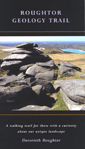
ROUGHTOR GEOLOGY TRAIL
North Cornwall District Council 70p
A folding 10-page pocket-sized pamphlet with 21 coloured illustrations including a geology map.
A clear trail map and directions cover a two mile (3km) walk of about two hours which gives confidence for an exploration of the geology and granite scenery of Rough Tor on Bodmin Moor. Attention is drawn to evidence of mining, china clay and quarrying as well as explanations for some of the strange landscape features of the granite landscape.
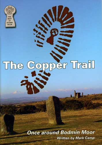 THE COPPER TRAIL. Once around Bodmin Moor by Mark Camp (2005) £4.95 48 pages over 50 colour photos 10 maps.
 ISBN 978-0-9544912-3-9
A circular walk around the whole of the moor. Taken in its entirety this is about sixty miles but, conveniently for most people, it is divided into day-walks. Included in the walks are high moor, remote farms, ancient monuments including clapper bridges, mines and ruins.
OUT OF STOCKThe Moor Circular walk.
- Day One Minions to St Neot. Distance 8 miles.
- Day Two St Neot to Bodmin. Distance: 13 miles.
- Day Three Bodmin to St Breward. Distance: 10 miles :St Breward to Camelford. Distance 6 miles.
- Day Four St Breward to Camelford. Distance 6 miles.
- DAY Five Camelford to Five Lanes. Distance: 10.5 miles.
- DAY Six Five Lanes to Minions. Distance: 9 miles.
This set of three volumes consists of 18 walks in or around Bodmin Moor. Together, the walks cover all 18 parishes of Bodmin Moor. The walks are designed to enhance your enjoyment of the area. They all contain clear walking instructions but each feels more of a countryside companion, taken in the company of the author Mark Camp, who weaves together elements of the landscape, local history and archaeology of the moor and its surroundings. Each walk is classified from * (easy) to ***** (strenuous and involving some walking over rough moorland and rugged wilderness).
Six Walks on and around Bodmin Moor. Volume One by Mark Camp (2003) ISBN 978-0-9544912-0-828 pages, 6 walking maps. 41 colour photos.£2.95
- Walk 1 On the edge (St Breward Parish) ** Distance: 2.5 miles.
- Walk 2 The Peaceful Valley (St Clether Parish) ** Distance: 1.5 miles.
- Walk 3 In Search of White Feathers (St Neot Parish) ** Distance: 3.5 miles
- Walk 4 Two Bridges Walk (Blisland Parish) * Distance: 2.5 miles.
- Walk 5 Quoits, Crows and Copper (St Cleer Parish) ** Distance: 3.5 miles.
- Walk 6 In the Hawk’s Shadow (North Hill Parish) ** Distance: 4 miles.
Six Walks on and around Bodmin Moor. Volume Two ~ Mark Camp (2004)
ISBN 978-0-9544912-1-528 pages. 6 walking maps. 36 colour photos. £2.95
- Walk 1 Warleggan, Whispers & Wind (Warleggan Parish) ** Distance: 3 miles.
- Walk 2 The Lanes of Lewannick (Lewannick Parish) * Distance: 3.75 miles.
- Walk 3 A Short Walk in a Small Parish (Michaelstow Parish) ** Distance: 2.75 miles.
- Walk 4 A Victorian Village Walk (Pensilva, St Ive Parish) ** Distance: 3 miles.
- Walk 5 To Helland and Back (Helland Parish) * Distance: 4 miles.
- Walk 6 To Summer Pastures and White Gold (Advent Church Parish) **Distance: 5 miles.
Six Walks on and around Bodmin Moor. Volume Three ~ Mark Camp (2005) ISBN 978-0-9544912-2-2 32 pages. 6 walking maps. 50 colour photos. £2.95
- Walk 1 The Four Rectorys Walk (St Tudy Parish) ** Distance: 2.5 miles.
- Walk 2 To Venture Forth (Altarnun Parish) ** Distance: 5 miles.
- Walk 3 The Other Cardinham Walk (Cardinham Parish) ** Distance: 3 miles.
- Walk 4 The Mines and Mills Walk (Linkinhorne Parish) ** Distance: 9 miles.
- Walk 5 The Crooked River Walk (Camelford Parish) ** Distance: 4 miles.
- Walk 6 The Contractual Obligations Walk (Davidstow Parish) ** Distance: 2.5 miles.