Menu

Cornwall

Devonshire

Wessex

Oxfordshire

Thematic Trails

Cornwall - North Cornish Coast

Booklets on this coastal landscape include geology, lime kilns, Boscastle floods, Bude and Tintagel,

map of Cornwall

Click on the map to see the range of publications we stock covering Cornwall.


NORTH CORNWALL GEOLOGY GUIDE
Heulyn Lewis £3.99 Picture of Cornwall geology guide

North Cornwall District Council 2006.The 46 stout, glossy, water-resistant pages with an easy-to-open wire binding are designed for outdoor use. There are over 150 colour illustrations, including many thumb-nail photos, which, together with written descriptions, encourage the identification of local rocks and minerals. This introductory companion guide includes sections on geological history, structure, mining and quarrying and is designed to enhance the enjoyment and understanding of this unique area.


THE LIME KILNS OF NORTH CORNWALL North Cornwall District Council 70p

A folding 10-page pocket-sized pamphlet with 12 illustrations and a location map. Topics headings include; limestone; the industry; imports; lime kilns; the lime burning process; uses. Specific kiln sites are described in Bude, Crackington Haven, Boscastle, Tintagel, Port Gaverne, Port Isaac, Egloshayle, Wadebridge, Camel estuary, Padstow, Trenault, Hick’s Mill, Larrick, South Petherwin, Wishworthy and Launceston.


TREVONE GEOLOGY TRAIL North Cornwall District Council 70p

A folding 10-page pocket-sized pamphlet with 27 coloured illustrations including a geology map. A clear trail map and directions cover a two and a half mile (4km) walk of about three hours which explores the geology and landscape of this coastal walk. Local fossils, rocks and minerals are illustrated as well as explanations of coastal scenery and evidence of old mining and quarrying activity.


BUDE GEOLOGY TRAIL North Cornwall District Council 70p

A folding 10-page pocket-sized pamphlet with 22 coloured illustrations including a geology map. A clear trail map and directions cover a two and a half mile (4.5km) walk of about two hours which helps you to explore the coastal scenery and geology of the Bude coastline. Coastal features discussed include folding, ripple marks, load casts, liesegang rings and turbidites. The port’s industrial heritage including the canal, lime kilns and the breakwater are also illustrated.

Cover of Crackington Geology Trail


CRACKINGTON GEOLOGY TRAIL North Cornwall District Council (2007)  70p

A folding 10 page pocket-size pamphlet with 24 colour photographs and maps. A clear map of the trail and an associated geology map offer directions and a commentary for a 5 mile, 8 km, (two hour?) circular walk along the coast. Topics include minerals and mining, quarrying, coastal features and a look at beach pebbles.

Image of Boscastle coast

BOSCASTLE AND TINTAGEL GEOLOGY TRAIL North Cornwall District Council (2007) 70p

A folding 10 page pocket-size pamphlet with 24 colour photographs and maps. Clear directions accompany a trail map and an associated geology map, together offering a commentary for a (three hour?) coastal walk of approximately 5 miles, 8 km, between Boscastle and Tintagel. Topics include coastal features, the area’s industrial heritage and local rocks, fossils and minerals.


PENTIRE GEOLOGY TRAIL North Cornwall District Council 70p

A folding 10-page pocket-sized pamphlet with 24 coloured illustrations including a geology map. A clear trail map and directions cover a four mile (6.5km) walk of about three hours which encourages an exploration of the varied geology of the Pentire peninsula. Landscape features are explained whilst a series of thumb-nail photos facilitate the recognition of rocks and minerals associated with Pentire’s industrial mining heritage.


PORTREATH GEOLOGY GUIDE Ade Marks (2000)
A5. 40 pp. 100+ colour illustrations. £2.95 An introduction to the local coastal geology of North Cornwall by a beach walk and a walk through the village looking at building stones.
Now out-of-print


Image of Boscastle flood booklet

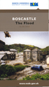
BOSCASTLE - The Flood North Cornwall Coast and Countryside Service   70p
A folding 10-page pocket-sized pamphlet with 24 coloured illustrations and a rainfall map. The pamphlet explains how the 2004 flood happened, the sequence of events and the aftermath. Attention is drawn to the frequency of flash floods in the South-West, including the Lynmouth Disaster of 1952 (see Lyn in Flood, Watersmeet to Lynmouth [Thematic Trails 1990]). The prospect of future Boscastle floods is considered.

BOSCASTLE 16 August 2004 – the day of the flood. David Rowe
ISBN 978-1-85022-193-7 Truran 2004   £4.99
A5.  64 pages. 68 colour photographs.
In this ‘human story’ about the flood, Cornish journalist, David Rowe, records many original and compelling accounts to tell the story of that fateful day. In many ways it complements the 10 page pamphlet (see above) which explains how the flood happened.


 You will find further "Rivers in Flood" booklets HERE